Geologists, farmers, engineers, builders and researchers are among those who need to test the soil of a project they are working on. Imagine the benefits of knowing the various properties of a location’s soil before planting a crop, drilling for a pipeline, or digging a foundation for a skyscraper. And one of the first places to start with is the soil’s colour. Colour can tell you many things about the soil, including its organic matter, wetness and aeration status.
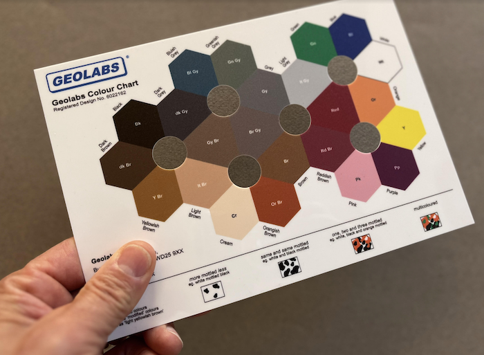
Geolabs, a UK-based geotechnical laboratory, has developed a chart to help people in the field identify soil colours. This colour-coded chart is placed directly atop the soil, allowing an individual to determine the soil’s actual colour. The durable plastic card has a network of 23 colours linked tonally in a hexagonal pattern, complete with six windows for easy viewing. The printed spectrum on the card ranges from black and dark brown to purple and pink. This handy guide eliminates the guesswork and provides a standardized naming protocol – a clever, down-to-earth solution.